- This topic has 6 replies, 7 voices, and was last updated 4 years, 7 months ago by
 Chawarat Rotejanaprasert.
-
AuthorPosts
-
-
2021-06-25 at 6:01 pm #28030
 Pacharapol WithayasakpuntParticipant
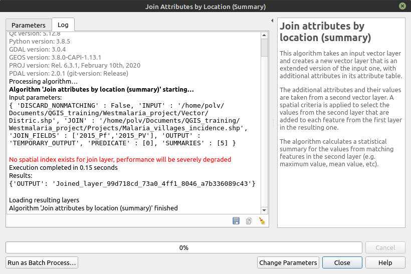
No spatial index exists for join layer, performance will be severely degraded.

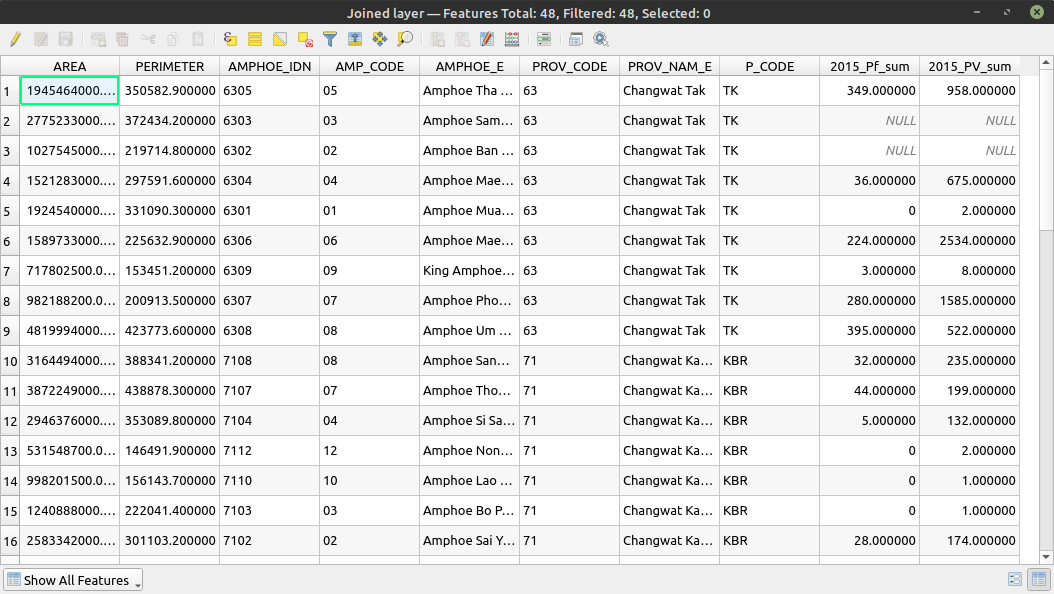
I don’t know if this is expected, but upon viewing Attribute Table, it seems to be as expected.

-
2021-06-26 at 10:02 am #28034
 Sittidech SurasriParticipant
I have the same experience as your post ” No spatial index exists for join layer, performance will be severely degrade. However, after follow all step as instructed you will get the result as expected.
-
2021-06-27 at 12:49 pm #28048
 Pongsakorn SadakornParticipant
It is a warning message, but still working as the result shown.
-
2021-06-27 at 3:52 pm #28064
 Kaung Khant TinParticipant
I found it too. Anyway, the results are as expected. Maybe the teacher might explain to us why that warning message appears.
-
2021-06-27 at 8:17 pm #28067
 Sila KlanklaeoParticipant
I have the same problem but It has data displayed in attributes.
-
2021-06-27 at 11:03 pm #28068
 Wachirawit SupasaParticipant
I’ve got some tutorial on this website: LINK
They’ve said
“Spatial Indexing
When you ran your model, you may have noticed a warning message No spatial index exists for the input layer, performance will be severely degraded. This is because certain spatial queries make use of a spatial index and QGIS warns you when having a spatial index can speed up your operations. PostGIS documentation has a good overview of spatial indexes and why they are important.
You can compare a spatial index to a book index. When you want to search for a particular term, rather than scanning each page sequentially, you can speed up your search by looking up the index and directly going to the pages where the word appears. Spatial indexes work in similarly. You spent the effort once to create the index and all subsequent operations can make use of it. When you create a spatial index, each feature’s bounding box is used to establish its relationship with other features. This is stored alongside the dataset and can be used by algorithms. When trying to determine spatial relationships, the algorithms speed-up the look-up using the following two-pass method:
Step 1: Use the spatial index to determine which target features’ bounding boxes intersect with the source feature’s bounding box. Since the spatial index already has computed this – this is very fast. The result is a list of candidate features.
Step 2: Now that there is a small subset of candidate features, iterate over them and use their full geometry to evaluate exact intersections.”More info on PostGIS website: LINK
Here are some excerpt
“Recall that spatial index is one of the three key features of a spatial database. Indexes make using a spatial database for large data sets possible. Without indexing, any search for a feature would require a “sequential scan” of every record in the database. Indexing speeds up searching by organizing the data into a search tree which can be quickly traversed to find a particular record.
Spatial indices are one of the greatest assets of PostGIS. In the previous example building spatial joins requires comparing whole tables with each other. This can get very costly: joining two tables of 10,000 records each without indexes would require 100,000,000 comparisons; with indexes the cost could be as low as 20,000 comparisons.”
In short – We didn’t create a spatial index so the program will run a sequential scan all data, this might have a problem with large amount of data but because we have relatively small data so we won’t probably notice any diffence.
-
2021-06-28 at 2:52 pm #28070
 Chawarat RotejanaprasertKeymaster
Hello, One could use the spatial index for pre-processing which can improve the computing significantly for large datasets. However since our dataset is quite small, it would not matter much without a spatial index for our class assignments. Great comments! Keep up the good work!
-
-
AuthorPosts
You must be logged in to reply to this topic. Login here
